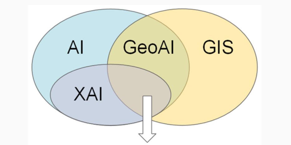
Ximeng Cheng*. Explainable AI applications in GIS. The Geographic Information Science & Technology Body of Knowledge (Issue 2, 2025 Edition), 2025.

Ximeng Cheng*. Explainable AI applications in GIS. The Geographic Information Science & Technology Body of Knowledge (Issue 2, 2025 Edition), 2025.
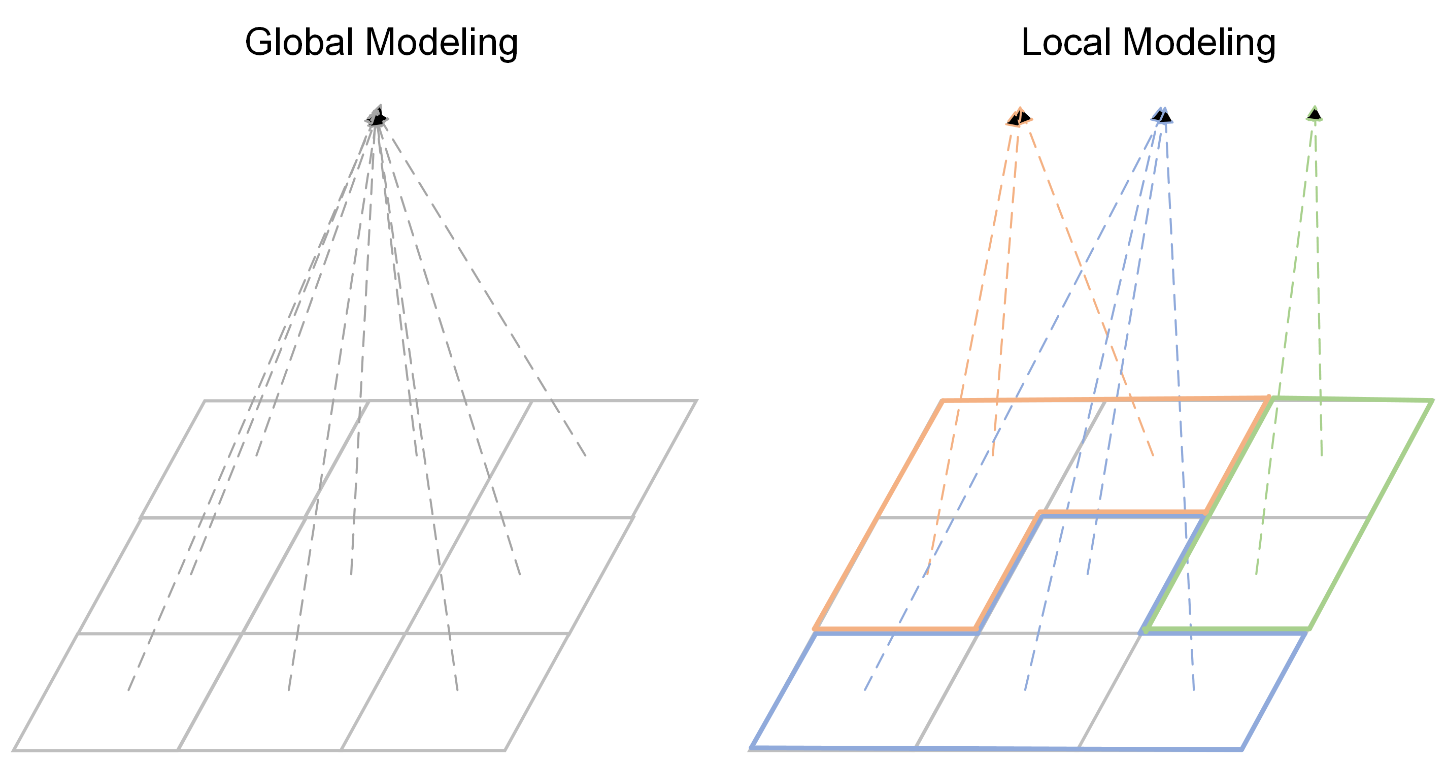
Ximeng Cheng*, and Jackie Ma. Global or local modeling for XGBoost in geospatial studies upon simulated data and German COVID-19 infection forecasting. Scientific Reports, 15(1):8858, 2025.
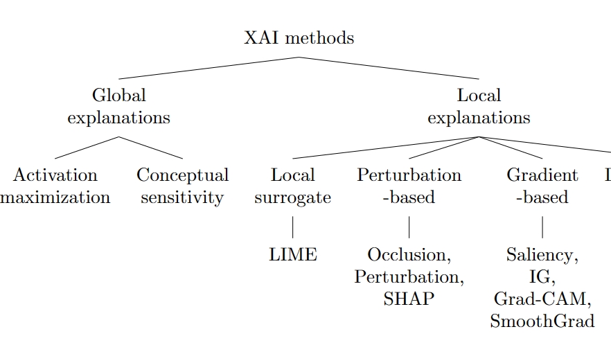
Ximeng Cheng, Marc Vischer, Zachary Schellin, Leila Arras, Monique M. Kuglitsch, Wojciech Samek, and Jackie Ma. Explainability in GeoAI. Handbook of Geospatial Artificial Intelligence, CRC Press, 177-200, 2024.
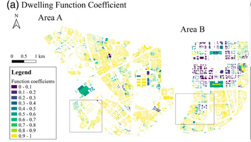
Jintong Tang, Ximeng Cheng*, Aihan Liu, Qian Huang, Yinsheng Zhou, Zhou Huang, Yu Liu, and Liyan Xu*. Inferring “high-frequent” mixed urban functions from telecom traffic. Environment and Planning B: Urban Analytics and City Science, 51(8):1775-1793, 2023.
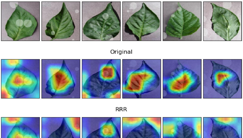
Ximeng Cheng*, Ali Doosthosseini, and Julian Kunkel. Improve the deep learning models in forestry based on explanations and expertise. Frontiers in Plant Science, 13:902105, 2022.
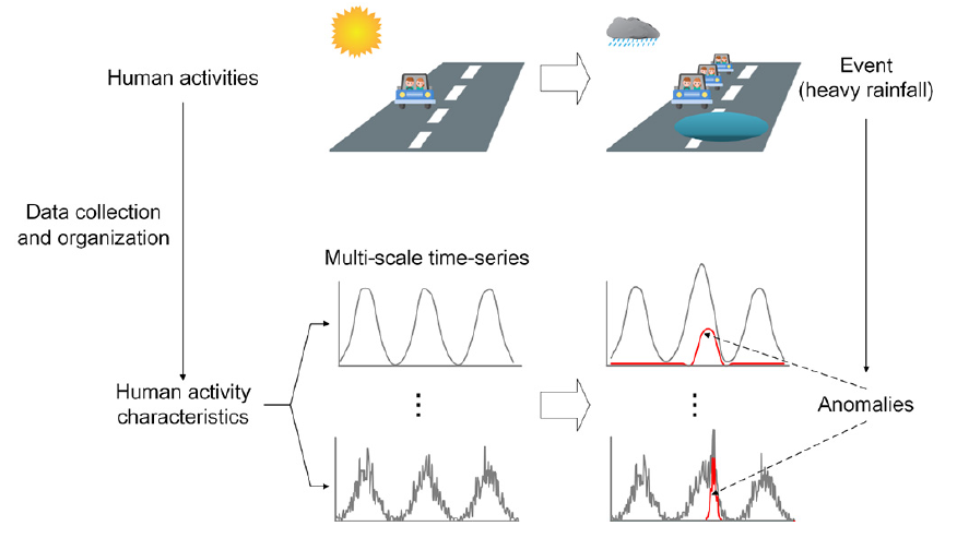
Ximeng Cheng*, Zhiqian Wang, Xuexi Yang, Liyan Xu, and Yu Liu. Multi-scale detection and interpretation of spatio-temporal anomalies of human activities represented by time-series. Computers, Environment and Urban Systems, 88:101627, 2021.
https://doi.org/10.1016/j.compenvurbsys.2021.101627
Online presentation at Geography Deparment, Humboldt-Universität zu Berlin
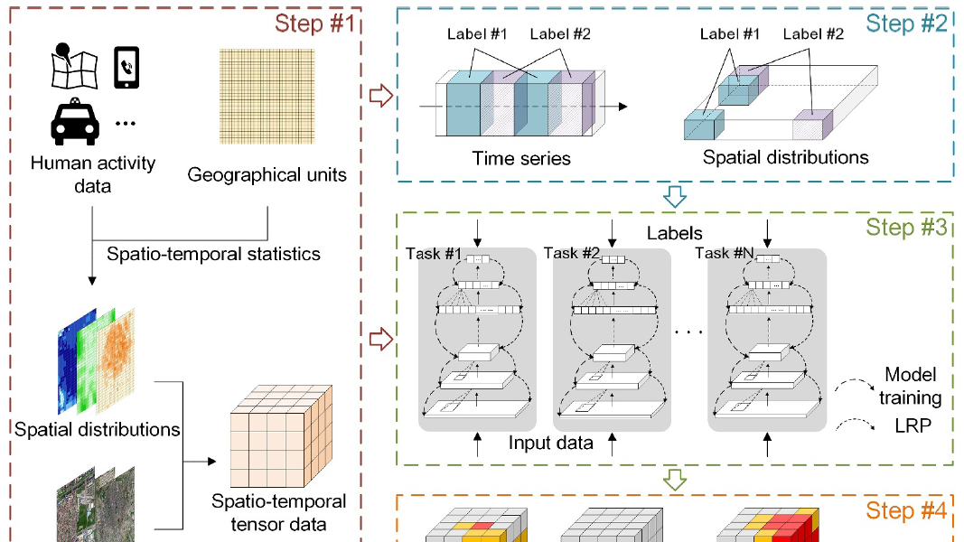
Ximeng Cheng, Jianying Wang, Haifeng Li, Yi Zhang, Lun Wu, and Yu Liu*. A method to evaluate task-specific importance of spatio-temporal units based on explainable artificial intelligence. International Journal of Geographical Information Science, 35(10):2002-2025, 2021.

Jesper Sören Dramsch, Monique M. Kuglitsch, Miguel-Ángel Fernández-Torres, Andrea Toreti, Rustem Arif Albayrak, Lorenzo Nava, Saman Ghaffarian, Ximeng Cheng, Jackie Ma, Wojciech Samek, Rudy Venguswamy, Anirudh Koul, Raghavan Muthuregunathan, and Arthur Hrast Essenfelder. Explainability can foster trust in artificial intelligence in geoscience. Nature Geoscience, 18:112-114, 2025.
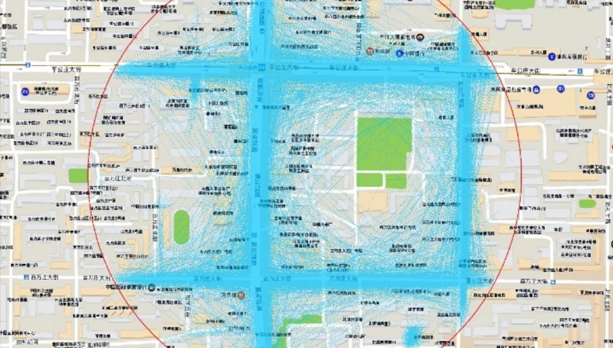
Fan Xia, Ximeng Cheng, Zhen Lei*, Jintao Xu, Yu Liu, Yingxin Zhang, and Qinghong Zhang. Heterogeneous impacts of local traffic congestion on local air pollution within a city: Utilizing taxi trajectory data. Journal of Environmental Economics and Management, 122:102896, 2023.
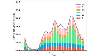
Lun Wu, Ximeng Cheng, Chaogui Kang, Di Zhu, Zhou Huang, and Yu Liu*. A framework for mixed-use decomposition based on temporal activity signatures extracted from big geo-data. International Journal of Digital Earth, 13(6):708-726, 2020.
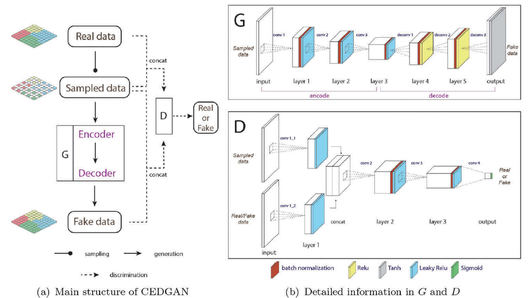
Di Zhu, Ximeng Cheng, Fan Zhang, Xin Yao, Yong Gao, and Yu Liu*. Spatial interpolation using conditional generative adversarial neural networks. International Journal of Geographical Information Science, 34(4):735-758, 2020.
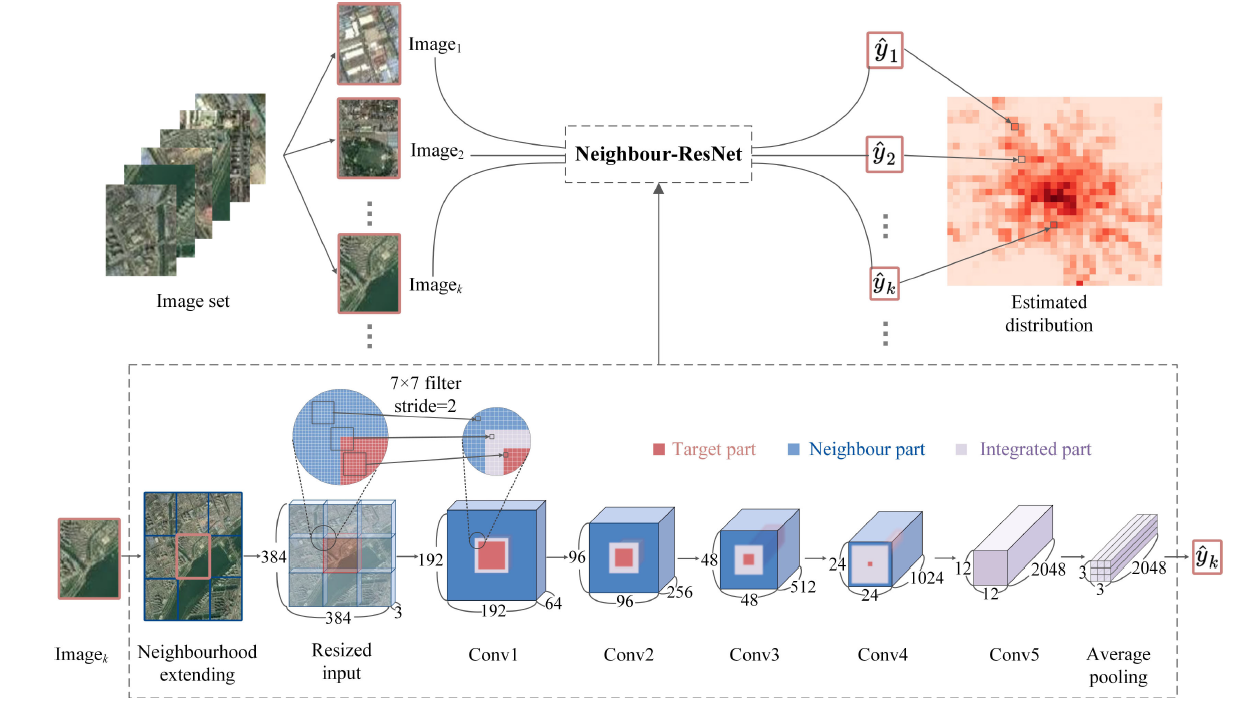
Xiaoyue Xing, Zhou Huang*, Ximeng Cheng, Di Zhu, Chaogui Kang, Fan Zhang, and Yu Liu. Mapping human activity volumes through remote sensing imagery. IEEE Journal of Selected Topics in Applied Earth Observations and Remote Sensing, 13:5652-5668, 2020.
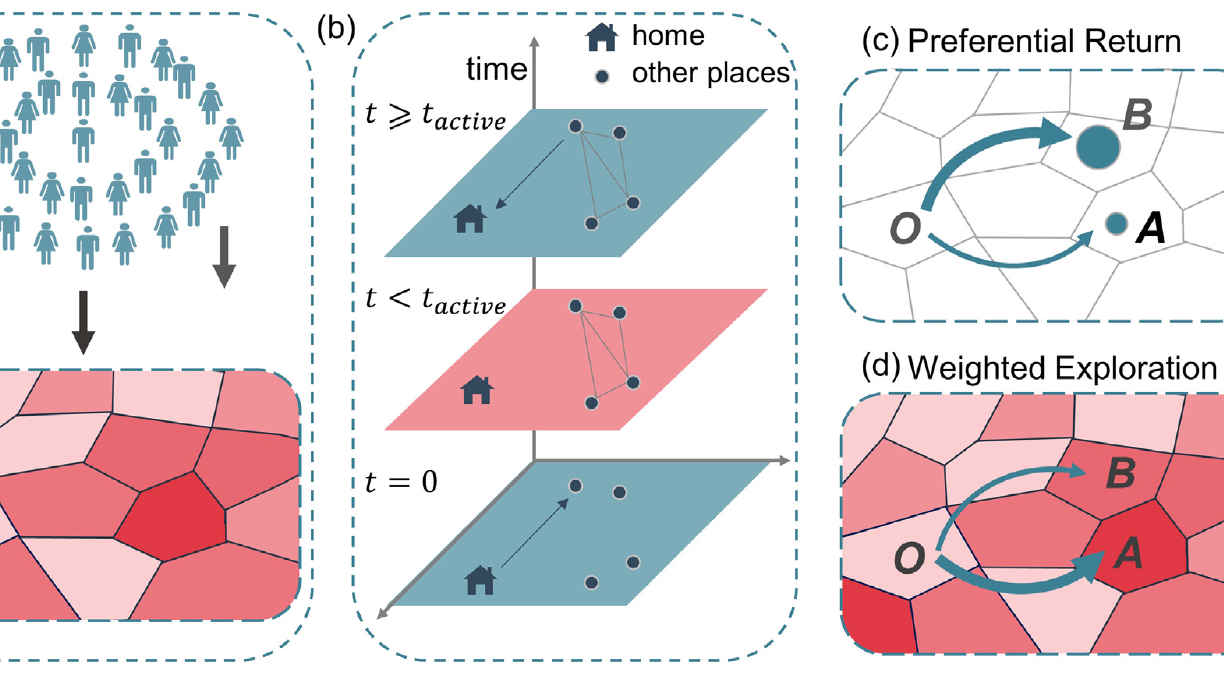
Jianying Wang, Lei Dong, Ximeng Cheng, Weijun Yang, and Yu Liu*. An extended exploration and preferential return model for human mobility simulation at individual and collective levels. Physica A: Statistical Mechanics and its Applications, 534:121921, 2019.
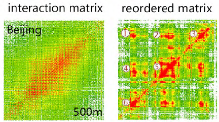
Shiliang Zhang, Di Zhu*, Xin Yao, Ximeng Cheng, Huagui He, and Yu Liu. The scale effect on spatial interaction patterns: an empirical study using taxi O-D data of Beijing and Shanghai. IEEE Access, 6:51994-52003, 2018.
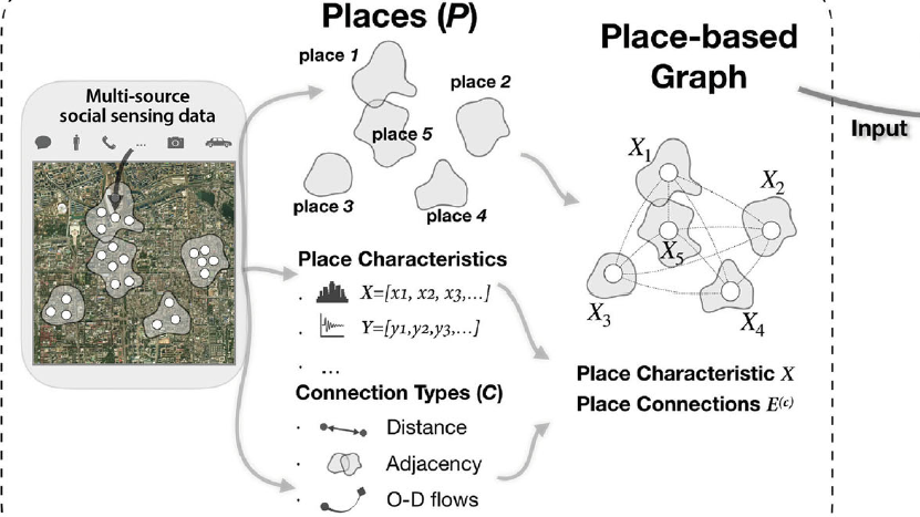
Di Zhu, Fan Zhang, Shengyin Wang, Yaoli Wang, Ximeng Cheng, Zhou Huang, and Yu Liu*. Understanding place characteristics in geographic contexts through graph convolutional neural networks. Annals of the American Association of Geographers, 110(2):408-420, 2020.
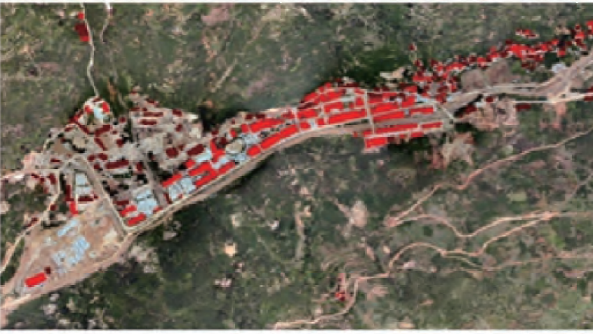
Ximeng Cheng*, Zhanfeng Shen, Tingyan Xing, and Wen Dong. Damaged building extraction and rapid assessment for earthquake disasters based on high-resolution remote sensing images [基于高分遥感影像的地震受灾建筑物提取与倒损情况快速评估]. Journal of Natural Disasters, 25(3):22-31, 2016. (In Chinese)
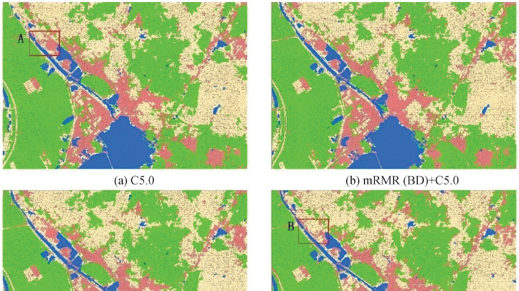
Ximeng Cheng, Zhanfeng Shen*, Tingyan Xing, Liegang Xia, and Tianjun Wu. Efficiency and accuracy analysis of multispectral image classification based on mRMR feature selection method [基于mRMR特征优选算法的多光谱遥感影像分类效率精度分析]. Journal of Geo-information Science, 18(6):815-823, 2016. (In Chinese)
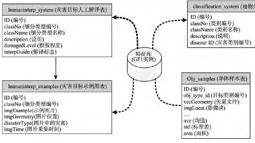
Wen Dong*, Zhanfeng Shen, and Ximeng Cheng. The rapid assessment method of earthquake disaster based on high-resolution remote sensing target feature library [基于高分辨率遥感目标特征库的地震灾情快速评估方法]. Journal of Geo-information Science, 18(5):699-707, 2016. (In Chinese)
1. Lingling Li, Zhanfeng Shen, Yida Fan, Tong Tang, Qi Wen, Wei Wang, Ping Wang, Wen Dong, Wei Zhang, Yueguan Lin, Yan Cui, He Huang and Ximeng Cheng. (09/10/2018): Building vector boundary simplification method [建筑物矢量边界简化的方法]. Chinese Patent (No CN105787977B).